John Morales’s voice cracks as he explains to his audience how tropical storm Milton had turned into a category five monster within hours.
“I apologise, this is just horrific.”
“It is just gaining strength in the Gulf of Mexico … where the seas are just so incredibly, incredibly hot, record hot.”
Straight off the back of the devastation left behind by Hurricane Helene, Milton developed at record-breaking speed, pushing “the limit allowable by physics” according to local weather experts.
A seasoned weatherman with 40 years of experience, Morales’s exasperation is palpable. “You know what’s driving that, I don’t need to tell you, global warming, climate change, is leading to this.”
To understand how global warming is supercharging hurricanes, it’s important to understand how they work.
Hurricanes form over the ocean, often beginning as a tropical wave, which is a low-pressure area, according to the National Oceanic and Atmospheric Administration (NOAA), the agency charged with forecasting and monitoring hurricanes in the US. “Hurricanes are powerhouse weather events that suck heat from tropical waters to fuel their fury,” NOAA says.
The warmer the water, the more power storms can gather. The water temperature in the Gulf of Mexico is so warm it’s like a “hot tub”, fuelling the rapid intensification of Hurricane Milton, with devastating consequences.
Oceans have suffered the biggest impact of global warming, soaking up the majority of the heat caused by the continuous burning of fossil fuels.
Powered by fossil fuels
Atmospheric scientist Kevin Trenberth has been studying the impact of climate change on hurricanes for decades. He says the warnings have been clear. “The very rapid intensity is almost certainly due to the very high ocean heat content, the very high sea surface temperatures,” Dr Trenberth says.
The extreme winds inside a hurricane stir up dramatic waves, typically drawing cooler ocean water up to the surface, which acts to weaken the hurricane.
But even beneath the surface, water has been heating up, adding even more fuel for hurricanes to intensify. “Nowadays it’s quite a bit warmer than it used to be, and as a result, that tends to fuel the storm more,” Dr Trenberth says.
“That’s the environment that creates extreme cyclogenesis — a very strong intensity growth in these storms, and so that’s very much a characteristic of the global warming that’s going on.”
Another phenomenon that comes into play is called eyewall replacement.
‘The eye never dies’
“What happens in a big, strong storm, is that the winds wrap up a very strong eye to such a point that the air is just going around and around, and it can no longer come in to the eye,” Dr Trenberth explains.
“The eye actually dies, and a new eye forms further out.” He says that before 2004, if that happened the storm typically weakened and went on its way, but that’s no longer the case.
“Now, with higher sea temperatures and higher ocean temperatures, the storm regenerates. “It can do this four or five times, and each time the storm gets bigger, so you end up with these great big storms that can produce tremendous damage.
“They also tend to be a bit slower-moving at that point, which means they are stuck in one spot where they can really pile more damage on top of more damage.
“These are some of the new factors that come into play with climate change.”
Charged with more water
It’s not just the speed and ferocity of tropical cyclones that are intensifying: the amount of water they can unleash has increased dramatically. Global warming has increased moisture in the atmosphere, and the higher temperatures climb, the more water evaporates, according to US space agency NASA.
“The more water vapour that air contains, the more energy it holds. This energy fuels intense storms, particularly over land.” Packing more water increases the destructive powers of hurricanes.
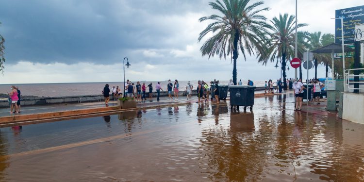
Just two weeks before Milton formed, Hurricane Helene hit coastal and inland communities, with heavy rainfall leading to devastating flooding.
At least 227 people died, the highest death toll from a hurricane on the US mainland since Katrina in 2005.
An initial rapid attribution study found that climate change may have caused as much as 50 per cent more rainfall during Helene in some parts of Georgia and the Carolinas.
“The exact numbers may change, but the fundamental conclusion that climate change increased substantially the rainfall in hurricane Helene will stand,” researcher Michael Wehner from the Lawrence Berkely National Laboratory in California says.
“We’ve looked at maybe 25 or 30 different storms, and each time we find a large increase in precipitation from climate change in these hurricanes.”
While Dr Wehner is shocked by the damaging hurricanes, he says he’s not surprised. “The phrase I’ve been using is, dangerous climate change is here now, I’ve been saying that for about 20 years,” he says.
“The suffering from severe weather has gotten worse in the United States, in Australia, in Europe, just about everywhere on the planet.”
Dr Wehner said climate change had turned the water in the Gulf of Mexico into a “hot tub”.
“We have additional moisture, but what we also have is additional energy, because it’s warmer,” he says.
“The storm is more violent and more efficient at precipitating out this increase in available moisture. It’s sort of a double whammy, you have more moisture and the storm is more efficient and so you get these very large increases in rainfall during these tropical cyclones.”
Brown oceans
Florida is known as being in the path of destructive storms but Helene hit regions further inland that are unused to hurricanes. There were two factors that played into the extreme rainfall brought by Hurricane Helene: wet ground and hilly terrain.
The radius of large storms like these can be up to 2,000 kilometres away and as the storm gets bigger, it reaches further out, grabbing moisture, according to Dr Trenberth. If the storm is over dry land, it can help weaken a storm, but if it’s over more ocean it will draw in more moisture.
In the case of Helene, the land was already very wet from preceding rain events, so it continued to gather moisture even after it hit land. “That’s sometimes referred to as the brown ocean,” Dr Trenberth says. “If there’s plenty of moisture around, that can indeed help keep the storm going.”
The regions hardest hit also had a lot of complex topography, according to Dr Wehner. “As the storm moves into the mountains, the Smoky Mountains, the winds are driving the air mass up the slope, further increasing the efficiency at which rainfall is generated,” he says.
Politics of preparation
Dr Trenberth first started researching the impact of climate change and increasing temperatures on hurricanes in the early 2000s, but back then he was met with fierce criticism.
“I made some comments about how I thought hurricanes should change with climate change, and people weren’t really talking about that kind of thing much at that time,” he says. “There was quite a bit of controversy.”
Dr Trenberth responded to his critics by publishing an article in Science Magazine in 2005. “The next season was when Katrina came along and devastated New Orleans, closely followed by Rita and Maria which devastated Puerto Rico.”
Since then, forecasting and modelling of major storms has significantly improved, but not everyone heeds the warnings.
Despite saying for decades that the burning of fossil fuels would increase the damage caused by tropical cyclones, Dr Trenberth says preparations remain woefully inadequate. “It tends not to happen well in Florida, and it tends not to happen well in Texas, these are so-called red states,” he says.
“The governors and the people there tend not to believe that there is global warming and a human influence and that it’s all just random, somehow or the other. He says while even developing countries are leveraging better information, politicising climate change has left parts of the US ill-prepared.
“The loss of life in recent times over in Pakistan and India has been greatly reduced because of the preparation and the planning and this is something that could improve quite a lot in some of the southern states of the US.”
“There’s excellent information from geostationary satellites on just what’s happening with the hurricane and where it’s going,” Dr Trenberth says.
“Some of it gets a little bit distorted, but some of the basic information is a lot better than it was even in the days of Katrina.
“Those are technological improvements and advances in weather services that have been very important.”
When Milton made landfall, it had weakened into a category three hurricane, causing dozens of tornadoes, snapping concrete electric poles, and overturning trucks. At least 10 people lost their lives and millions are left without power, but Governor Ron DeSantis said Florida had avoided the “worst-case scenario”.
As the heat has fuelled the intensity of hurricanes, a flood of misinformation has whipped up divide and distrust in communities already worn from disaster.
By Jess Davis / Courtesy ABC AU


